
The Other Boston Harborwalk: Walking the Waterfront in Dorchester
Boston’s Harborwalk doesn’t end at the Seaport. Head south and the city opens into shoreline, neighborhood paths, wide harbor views—and one of Boston’s most famous pieces of public art.
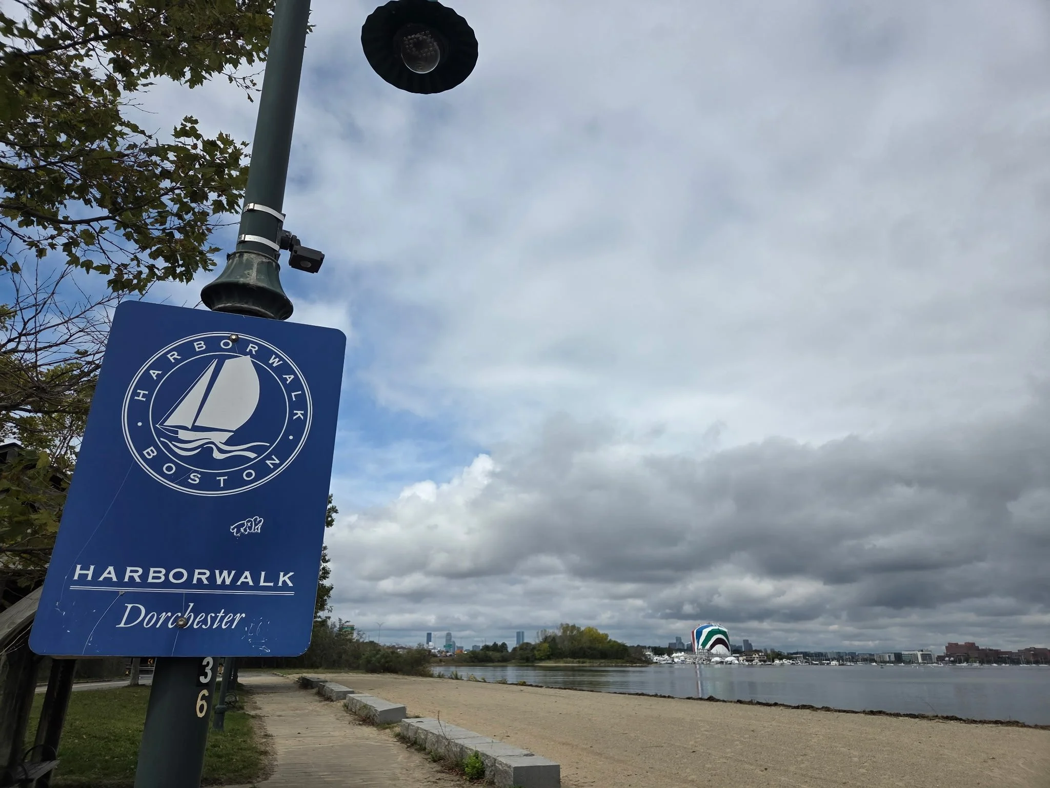
The Boston Harborwalk in Dorchester leads to a quieter, less familiar side of the city’s waterfront. Photo: Joyce Strong / GoBoston.com
When people think about walking along Boston Harbor, they usually picture the familiar waterfront: the North End, Christopher Columbus Park, the Aquarium, the Seaport, maybe Castle Island.
But Boston’s waterfront is much bigger than the postcard.
The Boston Harborwalk stretches for more than 40 miles along the city’s shoreline, connecting waterfront neighborhoods from the Neponset River in Dorchester through South Boston, the Seaport, downtown, the North End, Charlestown and East Boston.
And if you head south into Dorchester, Boston begins to feel different.
The buildings recede. The horizon gets wider. Trees, marsh, shoreline and open water take over, with the city still unmistakably present in the distance.
This is the Dorchester side of the Boston Harborwalk—and it is one of those places that reminds you how much of Boston exists beyond the places visitors are usually told to go.
Boston From the Other Side of the Harbor
The Boston Harborwalk isn't one continuous promenade with the same personality from beginning to end. It is a network of public waterfront paths connecting neighborhoods, parks, beaches, piers and commercial areas.
That's part of what makes exploring it interesting.
Downtown, the Harborwalk can feel intensely urban. You walk beside restaurants, hotels, office towers, boats and some of Boston's busiest attractions.
In Dorchester, much of the experience is quieter.
You can walk beside the water with Boston on the horizon instead of towering above you. Boats and marinas replace some of the downtown bustle. Trees and shoreline frame the harbor. On a cloudy New England day, the enormous sky becomes as much a part of the landscape as the city.
You're still in Boston.
It just doesn't necessarily look like the Boston people expect.
And That Giant Rainbow Tank? That's Boston History
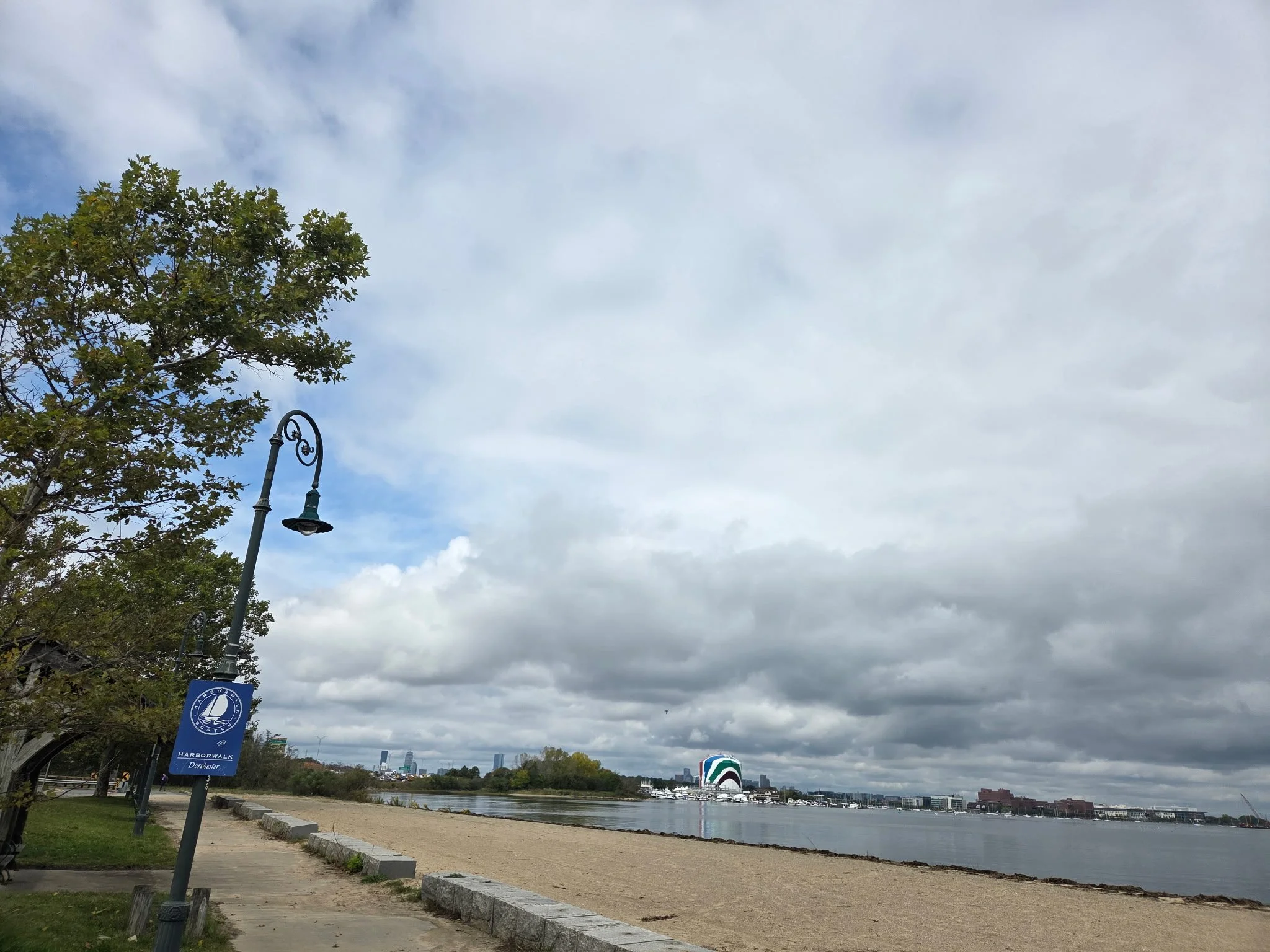
Across the water, Corita Kent's famous Rainbow Swash transforms a massive gas storage tank into one of Boston's most recognizable landmarks. Photo: Joyce Strong / GoBoston.com
If your eye immediately goes to that enormous striped tank across the water, you're looking at a genuine Boston icon.
It is Corita Kent's Rainbow Swash, a monumental piece of public art that has been part of the Boston landscape for more than half a century.
Boston Gas commissioned Kent to create the original design in 1971. Kent—an artist, educator, social activist and former Catholic nun—covered the enormous industrial structure with sweeping bands of vivid color.
Somehow, a gas tank became art.
And then the art became Boston.
The original tank was eventually demolished, but by then the Rainbow Swash had become so familiar to Bostonians that the design was recreated on the replacement tank in the 1990s.
There is also a piece of enduring Boston lore hidden—or supposedly hidden—in those stripes.
For decades, people have claimed they can see the profile of Vietnamese revolutionary Ho Chi Minh in the blue portion of the design. Kent rejected that interpretation, and there is no evidence that she intentionally placed his image there.
But the story persists.
That's Boston for you.
Give us an enormous rainbow-painted gas tank beside the Southeast Expressway and we'll give you half a century of history, art, politics and argument about what might be hiding in the blue stripe.
Today, the Rainbow Swash is such a familiar part of the landscape that generations of people traveling into Boston have used it almost subconsciously as a geographical marker:
There's the rainbow tank. We're in Boston.
From this stretch of the waterfront, though, you get something drivers on I-93 don't.
You get to stop and actually look at it.
A New Connection Along the Neponset
There is another reason to explore this part of Dorchester right now.
In April 2026, Massachusetts officials formally celebrated the completion of a new extension of the Neponset River Greenway, adding approximately 0.9 mile between Tenean Beach and Morrissey Boulevard.
The extension includes a paved shared-use path and a 670-foot boardwalk over the salt marsh and tidal habitat of Dorchester Bay, including a viewing area overlooking the harbor.
And yes—the Rainbow Swash is part of the view.
The project closed a long-standing gap in the trail network and extended the Neponset River Greenway to roughly nine miles through Dorchester, Mattapan, Hyde Park and Readville and into Milton, while creating a better connection toward the Boston Harborwalk.
For walkers, runners and cyclists, it makes this part of Boston considerably more interesting to explore.
The Harborwalk Belongs to the Neighborhoods, Too
One of the best things about the Boston Harborwalk is that it wasn't created simply as a tourist attraction.
The Harborwalk is about public access to Boston Harbor.
That matters in a city where so much waterfront land historically became industrial, commercial or privately developed.
And it matters particularly in Boston's neighborhoods.
Dorchester has miles of shoreline, yet someone visiting Boston for the first time could easily spend several days here without ever realizing it.
The waterfront around Dorchester Bay connects with open spaces around Savin Hill, Malibu Beach, Tenean Beach and the Neponset River.
This isn't necessarily the Harborwalk where you're constantly stopping to photograph historic buildings.
Here, the harbor itself is the attraction.
A Different Kind of Boston Walk
There is something refreshingly ordinary about this part of the waterfront.
People walk their dogs. Runners pass by. Neighbors sit near the water. Boats move across the harbor. Cyclists travel the Greenway.
And you can simply stop and look.
For visitors, that can be surprisingly valuable.
Boston is a compact city, and it's tempting to race from landmark to landmark: Faneuil Hall, Beacon Hill, Fenway Park, the Freedom Trail, the Public Garden, the North End.
They're worth seeing.
But occasionally the best way to understand a city is to leave its most famous few square miles.
Dorchester's waterfront gives you that opportunity without actually leaving Boston.
Bring a Camera—and Look Back
The views here change constantly with the weather.
On the day I took these photographs, heavy gray clouds hung over the harbor while patches of blue opened behind them. The Rainbow Swash stood across the water beneath an enormous New England sky.
It wasn't the classic brilliant-blue Boston tourism photograph.
I liked it better because of that.
This is what Boston actually looks like sometimes.
Moody. Coastal. Windy. A little unpredictable.
And beautiful anyway.
If You Go
Don't think of the Dorchester Harborwalk as a single attraction with a front door.
Think of it as territory to explore.
Different sections connect with neighborhood streets, beaches, parks and the Neponset River Greenway. Tenean Beach is one useful access point, with parking available and connections to the newer Greenway extension toward Morrissey Boulevard.
Wear comfortable shoes. If you're biking, spend a few minutes looking at the route before you leave. And bring an extra layer because conditions beside Boston Harbor can feel very different from conditions a few blocks inland.
Don't automatically save this walk for summer, either.
Spring and fall can be particularly beautiful here, when the air is cooler, the paths are quieter and the changing landscape reminds you that Boston is a coastal New England city.
Boston Is Bigger Than Downtown
That may be the real reason to explore the Harborwalk in Dorchester.
Boston tourism understandably gravitates toward the city's extraordinary concentration of history and landmarks.
But Boston isn't a collection of attractions.
It's a collection of neighborhoods.
Dorchester is one of the largest and most diverse of them, and its waterfront tells another piece of the city's story—industrial Boston, neighborhood Boston, natural Boston and artistic Boston all sharing the same shoreline.
So after you've walked the Freedom Trail, wandered the North End and explored the Seaport, consider heading farther south.
Find the Harborwalk sign.
Look for the Rainbow Swash.
Follow the water.
And see what Boston looks like from over here.
GoBoston Tip
The Harborwalk changes dramatically as it travels through Boston. Don't think of it as one enormous walk you have to complete. Pick a neighborhood or waterfront section and explore it at your own pace.
Come Along With GoBoston
GoBoston.com is where I explore the city itself—the neighborhoods, waterfront, history, food, sports, music, people and unexpected places that make Boston Boston.
My GoBoston community on Substack is where we can keep the conversation going.
That's where you can subscribe for free and follow along as I find more places worth seeing, stories worth telling and corners of Boston that don't always make the tourist guides.
And if you know a Boston place, neighborhood story, hidden walk, old landmark or local institution you think I should explore next, tell me.
There's always another Boston story.